
San Pablo ZIP Code Coverage
San Pablo's supported incorporated-city ZIP is 94806. USPS identifies the Mira Vista Post Office or station in San Pablo, uses the delivery label SAN PABLO CA 94806, and serves postal territory that reaches beyond the city line. The single-row table is intentional: no second official San Pablo ZIP, PO-box-only ZIP, or unique institutional ZIP was located in the researched sources.
| ZIP Code | Areas Covered | Post Office | Notes |
|---|---|---|---|
| 94806 | Incorporated San Pablo plus nearby unincorporated postal territory | Mira Vista Post Office / USPS station, San Pablo | Delivery geography is not the municipal boundary; verify each address |
Rollingwood, Tara Hills, Bayview, and Montalvin can use a San Pablo mailing address while remaining unincorporated Contra Costa communities. A mailing label therefore points to a postal route, not automatically to a San Pablo permit, police, planning, code, or disposal jurisdiction.
Why San Pablo Postal Territory Spills Out
Postal geography is built to move mail. City boundaries are built to assign municipal authority. Those systems overlap in San Pablo but do not match. The city specifically excludes unincorporated residents from city disposal services even when the mailing address says San Pablo. That statement is a useful local test for every postal directory result.
The mismatch matters when a family list, reunion notice, historical address, or public-record request carries only a postal label. A 94806 address outside the red-line city boundary may belong to county or neighboring-city systems for permits, police records, code cases, planning, and property questions. Use the postal label as the first clue, not as the final jurisdiction.
Geography check. A San Pablo mailing address can be correct for delivery and still be outside incorporated San Pablo. The USPS result and the city boundary result answer different questions.
USPS Controls for a San Pablo ZIP Code Check
The official USPS ZIP Code Lookup by Address is the first stop for delivery geography. The researched capture identifies an address-based lookup, but it does not verify a complete live control vocabulary. The table therefore names only the controls supported by the source and avoids inventing button labels or extra filters.
| Lookup mode | By-address mode at the USPS URL with the byaddress query. |
|---|---|
| Delivery address | Enter the address being checked for standardized delivery and ZIP information. |
| Returned postal result | Use the USPS city and ZIP response as the delivery label to compare with the municipal boundary. |
| Research limit | No researched USPS field list establishes a ZIP-wide resident, parcel, population, or neighborhood search. |
The USPS address lookup is a useful address normalizer. It can resolve whether a typed address is recognized for a postal route, but it does not decide which agency owns a permit or whether a parcel is incorporated. Save the tested address and returned ZIP before moving to the boundary step.
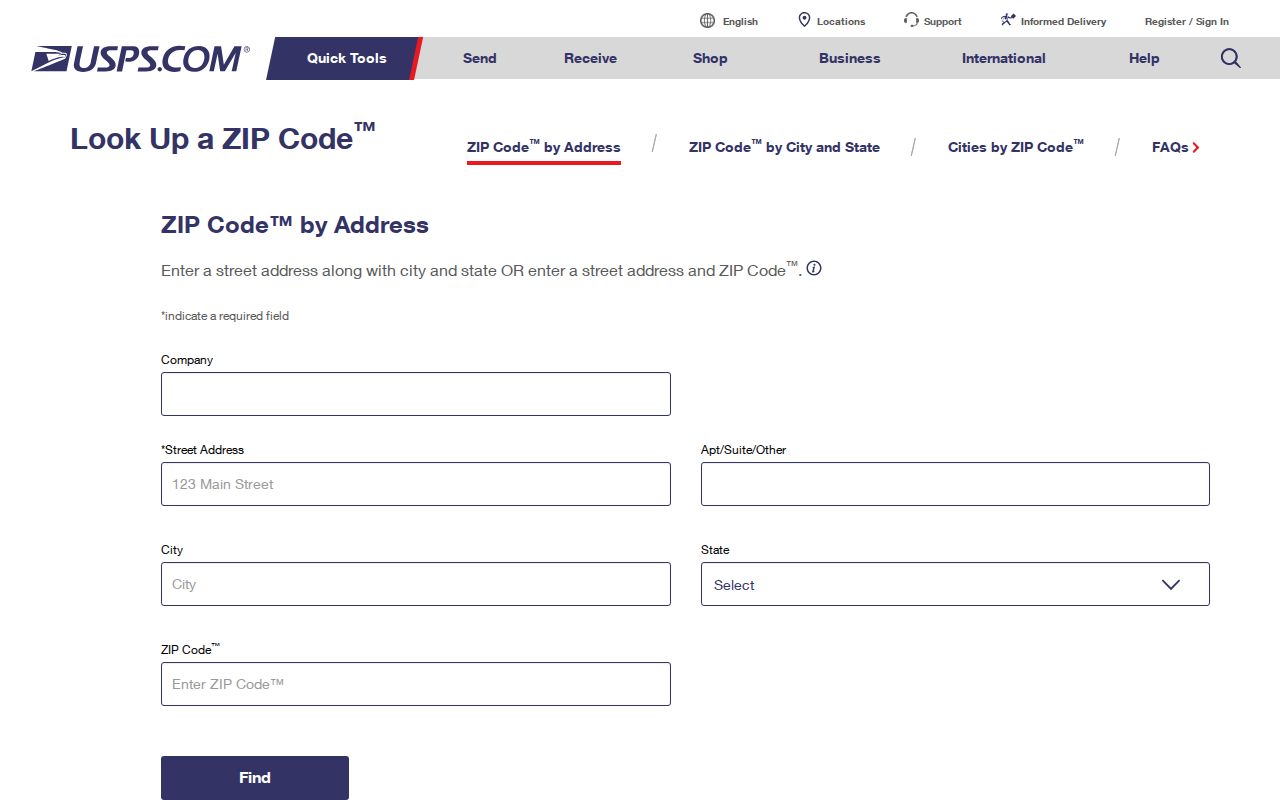
The USPS image ties the postal lookup to an actual address check. The next question is jurisdiction, not another postal search.
San Pablo City Limits After USPS
After USPS confirms the delivery label, open the San Pablo Incorporated City Limits boundary source. The red-line map is the jurisdiction check. It separates incorporated parcels from Richmond and unincorporated pockets that may share the same postal city. Keep the ZIP result and the boundary result as two separate source notes.
The city boundary also helps route records. If the parcel is inside San Pablo, eTRAKiT can be useful for permits, Planning/RHS, business licenses, and code cases. If it is outside, the same postal label does not make the San Pablo portal the right custodian. A ZIP code directory can narrow a location; the boundary decides which local office to test. The San Pablo General Plan source provides the planning context for the image below.
The General Plan map supplies planning context, while the incorporated-limits source supplies the boundary question. Neither creates a ZIP-wide resident list.
APN Steps Beyond a ZIP Code Directory
Once postal and city geography are clear, use the parcel's APN as the bridge into local records. An APN is the assessor's parcel number, a durable key that is usually more useful than a ZIP when a street number changes or a parcel borders another jurisdiction. No researched portal supports an official ZIP-wide resident or parcel search.
- Run the exact delivery address through USPS and save the returned postal city and ZIP.
- Compare the address with the San Pablo city-limit boundary, noting whether it is incorporated, Richmond, or unincorporated county territory.
- Use CCMAP with the address or APN, click the parcel, and record the site address, APN, deed reference, year, values, exemptions, and map links.
- Use San Pablo eTRAKiT only when the parcel is inside the city. Search address-keyed permit, Planning/RHS, license, or code modules.
- For ownership, move to the Contra Costa Assessor counter or request channel because owner names are suppressed from public web property tools.
ParcelQuest also searches by address or APN, not by ZIP or city, and does not expose online owner mailing information. CCMAP is free and interactive, but its map is not a certified ownership record. If the question turns from ZIP geography to a named street, the San Pablo street directory owns the address-keyed record chain.
Four Address Keys for San Pablo
A postal directory result becomes clearer when each address concept is kept in its own field. These terms look similar in a search note but point to different custodians and different proof.
- Situs address
- The physical location of the parcel or structure. It is the address used to locate the site, not necessarily the tax mailing address.
- Tax mailing address
- Where assessment correspondence is sent. It can differ from the situs and does not establish the current household.
- Legal description
- The deed's land description, such as subdivision, lot, and block language. It can bridge an old address to a stable parcel record.
- APN
- The assessor's parcel number used to connect CCMAP, assessment information, maps, and a deed reference.
- ZIP code
- A USPS delivery-routing area. It describes mail geography, not a municipal boundary or a list of residents.
Note: Keep the USPS result, situs, mailing address, legal description, and APN in separate columns when comparing records.
What San Pablo's ZIP Search Cannot Show
The researched local tools do not provide an official ZIP-wide resident or parcel directory. ParcelQuest has no ZIP or city filter. CCMAP searches by address or APN and shows mapped parcel context, not owner names or mailing addresses. eTRAKiT searches its city modules by address or other portal-specific controls, not all 94806 records. The Assessor's public web tools suppress owner names, with counter or request channels available for ownership research.
Voter status is also not a ZIP directory. County and state voter tools require identity fields, and Elections Code section 2194 limits voter-file release and use. A request for everyone on a ZIP or street is data-file access, not a casual name lookup. No official local ZIP split or realignment year, ZIP population series, or complete ZIP-wide resident inventory was located.
Those gaps are useful boundaries. They prevent a mailing label from being mistaken for a current household list and point the search toward a specific address, APN, custodian, or lawful record request.
San Pablo ZIP Code Geography in Context
San Pablo's geography has always crossed record systems. The name reaches back to rancho and township history, while the incorporated city dates from April 27, 1948. The local General Plan describes dense small parcels and a city interwoven with Richmond and unincorporated areas. That pattern explains why adjacent parcel research can change jurisdiction within a short distance.
For a family timeline or community history, the ZIP is still useful. It can group mail, frame a newspaper search, or help test whether an old address points to the San Pablo postal area. Pair it with the boundary, APN, census, directory, or newspaper source that gives the human or parcel detail. A postal area is a starting lens, not the record itself.
Published population figures also show why a ZIP code directory should not invent a local series. The 75th Anniversary brochure compares 14,476 people and 4,244 households in 1950 with 32,127 people and 9,446 households in 2020. A General Plan source reports 31,413 people in 2020 instead. Keep those figures tied to their named source and vintage; neither is a 94806 count. The plan also estimates about 12,000 residents per square mile, described as the Bay Area's third-highest density, using cited ACS-era estimates. These are city-level context, not postal proof.
Human Uses for San Pablo ZIP Data
A careful postal search can help a family sort old letters, confirm which branch or newspaper serves an address, or separate two records with the same street name. It can also prevent a wrong public-record request by showing that a San Pablo postal label belongs to a nearby unincorporated community. Those are useful, bounded questions.
For each result, save the address as entered, the USPS response, the city-boundary check, and the APN if one is available. Then choose the next source based on the question: eTRAKiT for an incorporated city permit, CCMAP for parcel context, the Assessor for public roll assistance, or the county and state systems for identity-gated records. If the goal is a full named-street chain, switch to the street-by-address workflow rather than stretching the ZIP code beyond what it can prove.
Boundary limit. A ZIP code can group delivery addresses across several jurisdictions. Do not use it to infer a person's residence, a parcel owner, or an agency's custody without the second source.